Beehive Mapping portfolio
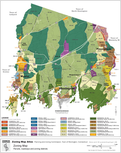
Zoning Map Atlas
Stonington, Connecticut, 2006
Working from GIS data in ESRI Arc format supplied by the planning and zoning commission, a new map design for the atlas overview and detail pages was developed. Map linework was edited and labeled in Adobe Illustrator, and output as PDF files for each map sheet.


Click on thumbnails to view portfolio pages.
Hover over the sample to zoom in.
Highlight a category of maps from the menu above.
