Beehive Mapping portfolio
Boston Neighborhood Asset Mapping Project
Boston Alliance for Community Health (BACH), 2012-2013
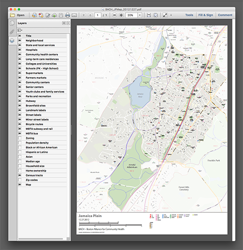
Multi-layered PDF maps for Boston neighborhoods (Allston-Brighton, Charlestown, Chinatown, Codman Square, East Boston, Jamaica Plain, Mattapan, Roxbury, South Boston, South End). Within each map file, data layers with demographic, zoning, brownfields and community resources can be turned on and off, as in a GIS.
Click on thumbnails to view portfolio pages.
Hover over the sample to zoom in.
Highlight a category of maps from the menu above.
