Beehive Mapping portfolio
Urban Development of Boston
Tunney Lee and James Madden
Boston: People, Place and Planning website (2013)
Sequence of maps of Greater Boston showing successive eras of urban development: landmaking along the waterfront, expansion of residential neighborhoods along the trolley lines, and suburban development along Route 128.
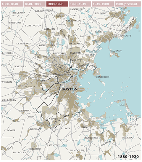
Click on thumbnails to view portfolio pages.
Hover over the sample to zoom in.
Highlight a category of maps from the menu above.